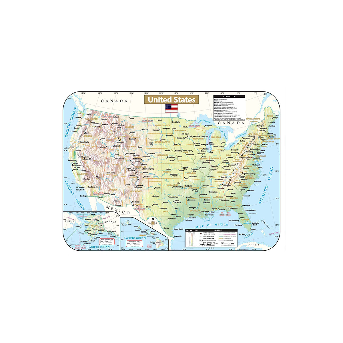
The United States Shaded Relief Topographical Wall Map by Kappa Map Group provides historical, geographical, and anecdotal information, inset maps of Alaska and Hawaii, an elevation chart, symbols and names for the national capitol, state capitols, and major cities. Also shows international and state boundaries, the Continental Divide, time zones, and county boundaries. Measures 28" x 38".
No customer reviews for the moment.